Mount St. Helens National Volcanic Monument is an incredible place to visit and was definitely a highlight of our trip to Washington State. Mount St. Helens erupted more than three decades ago killing 57 people and destroying more than 200 square miles of forest. In 1980, after almost 123 years of hibernation, the mountain rumbled with a two month series of earthquakes, one of which caused the entire north face to slide away. The volcano responded by exploding a hot mix of lava and rock so fast that it overtook the avalanching north face. Before the eruption in 1980 occurred scientists were able to convince authorities to close Mount St. Helens to the public and keep it closed. Their efforts saved thousands of lives. The lateral blast which was loaded with volcanic debris caused devastation as far as 19 miles from the volcano.
Where is Mount St. Helens Located?
Mount St. Helens is located in the state Washington in the Pacific Northwest region of the United States It is located off I-5 approximately 3 hours south of Seattle, Washington and 1-1/2 hours north of Portland, Oregon. There are two main visitor centers, Johnston Ridge Observatory at milepost 52 and the Forest Learning Center at milepost 33. Traveling on I-5 from Seattle take exit 63 through Toledo and coming from Portland take exit 49, Castle Rock. Mount St. Helens can be reached from Highway 504. You can find deals for lodging in any of these areas here at Booking.com.
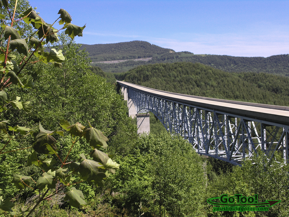
Hoffstadt Creek Bridge on Hwy 504
Hoffstadt Creek Bridge on Spirit Lake Memorial Highway (Hwy 504) is the third tallest bridge in the Northwest at 370 ft above the ground below. It opened in 1991 to replace the original highway that was destroyed by the 1980 eruption of Mount St Helens. There is a viewpoint and parking area on the west end of the bridge. At this point you will be entering Mt. St. Helens blast zone.
About Us

Hi! We are Lou and Barbara, a world traveling, nature loving couple searching out new and interesting places to explore, photograph and share with you our readers.CONTINUE READING
What is Mount St. Helens
Mount St. Helens is the most active volcano in the contiguous United States. It is a stratovolcano known for one of the most violent natural disasters of our time. In 1980 a massive eruption of Mt. St. Helens sent ash, steam, water and debris upward to a height of 80,000 feet while an entire mountainside slid away.
Visiting Mount St. Helens National Volcanic Monument
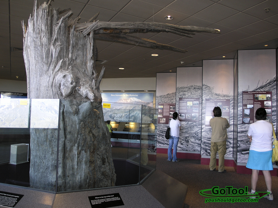
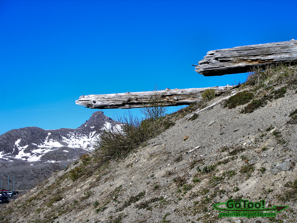
In 1982 Mount St. Helens National Volcanic Monument was established. The 110,000 acre area was set aside for education, research and recreation while the environment was left to recover from the disaster naturally. More than thirty years later much of the devastation from the eruption of Mount St. Helens can still be seen as well as evidence of how violent the eruption was. Huge trees were ripped into mere splinters and thrown or swept miles away. The two main visitor centers within the monument have displays, movies and information on Mount St. Helens and its history that we found very interesting and educational.
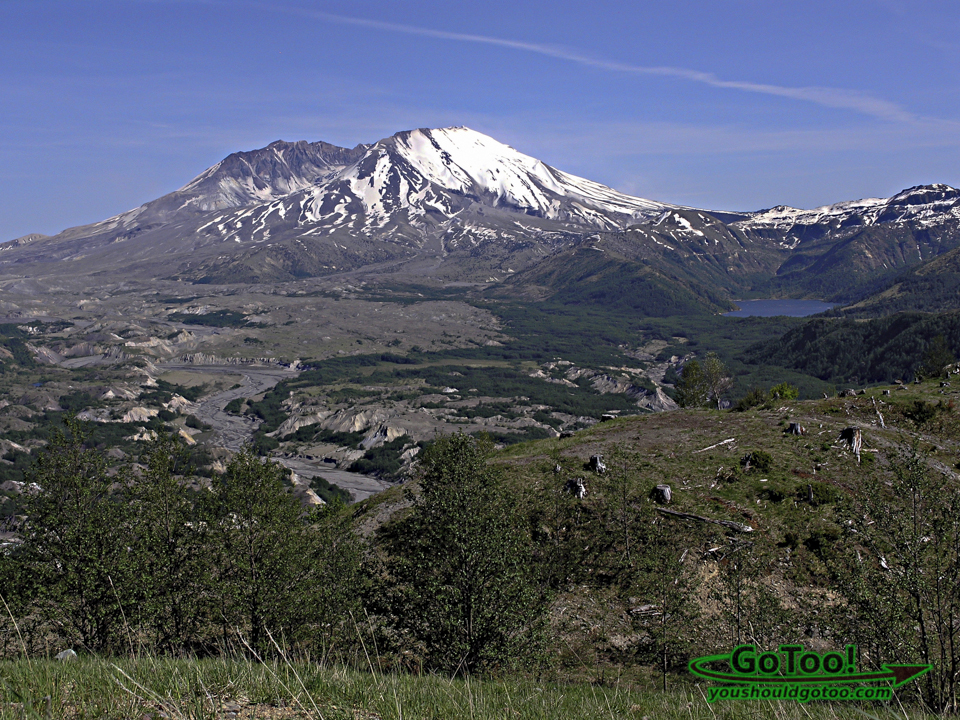
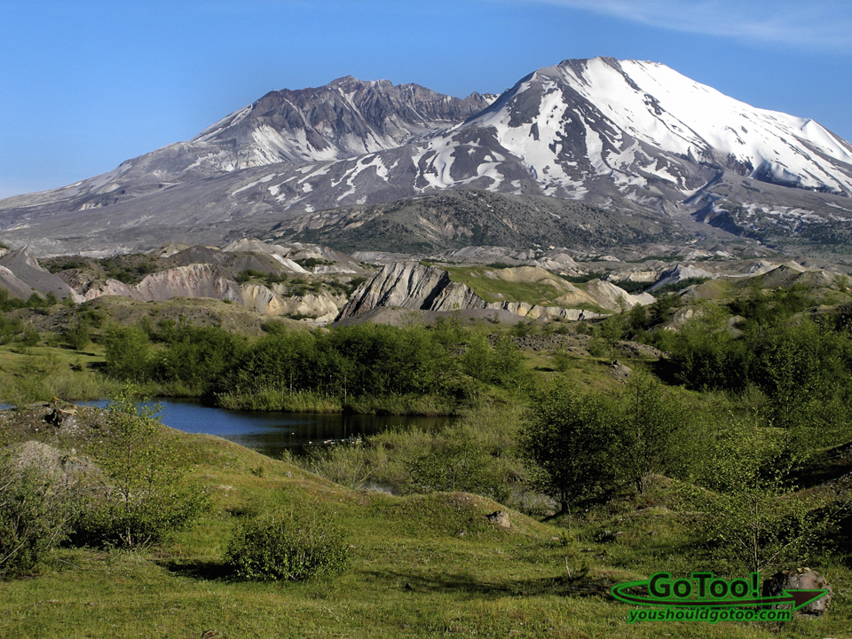
Mt. St. Helens can be seen in the distance with a view of Castle Lake on the right. This photo was taken from one of the overlooks on our way to visit Johnston Ridge Observatory. The pumice plain from the 1980 eruption can be seen in the North Fork Toutle River Valley. The valley is filled with landslide deposits as well as trees that were toppled in the volcanic mudflow. New growth is beginning to cover the valley floor.
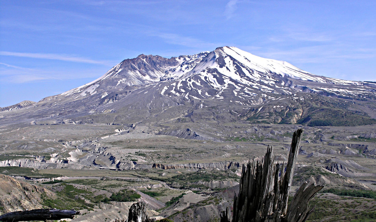
Mt. St. Helens and a view of the massive crater that was created by the 1980 eruption. Remnants of the aftermath of the blast and the devastated landscape can be seen everywhere. The destruction from the violent eruption is an unforgettable sight to see.
Other scenic areas you may be interested in:
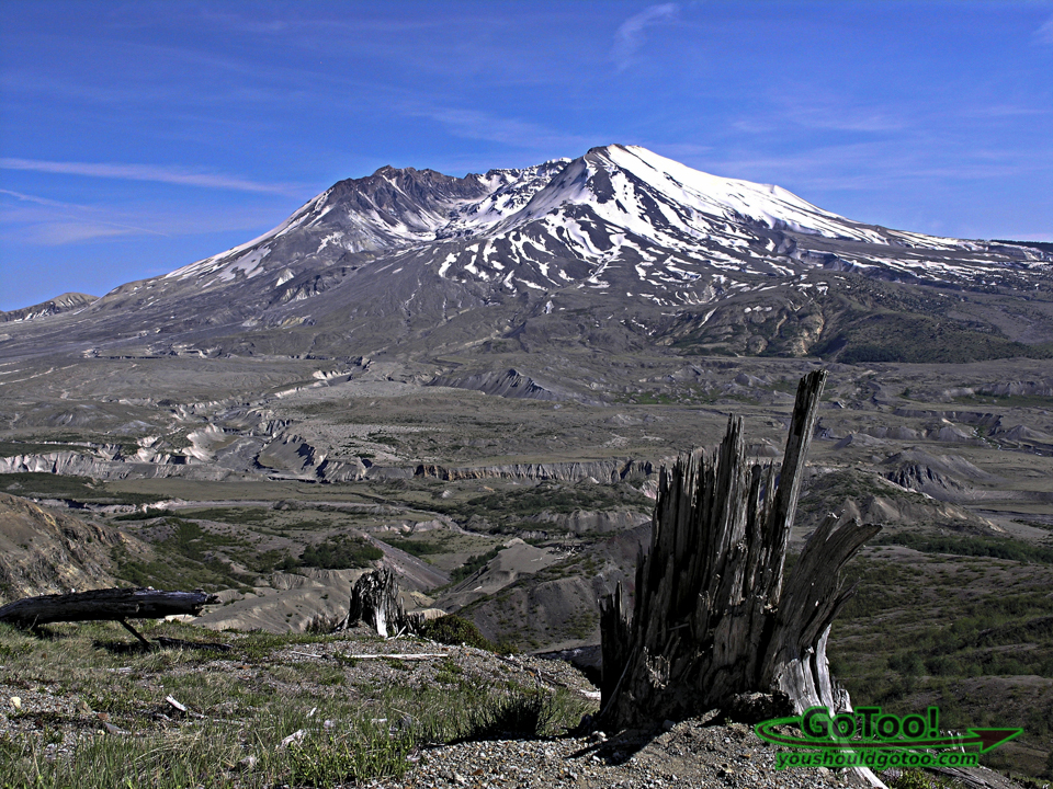
The power of the volcanic explosion can be seen in the damage done to Mt. St. Helens and the surrounding environment. Sediment filled with ash and volcanic debris clogs the valley floor.
Visiting Johnston Ridge Observatory
The Johnston Ridge Observatory opened in 1997 and is located by the site of vocanologist David A. Johnston’s camp on the morning of May 18, 1980. Johnston was a principal scientist on the monitoring team who died while manning the observation post 6 miles away on the day of the eruption. He was the first to report the eruption by transmitting the words “Vancouver! Vancouver! This is it!” before being swept away by the lateral blast.
The Johnston Ridge Observatory is located 52 miles east of Castle Rock, Washington on Hwy 504. There are exhibits on the geologic history of the volcano, volcanic activity monitoring and eyewitness accounts of the eruption. There is also a movie that documents the massive eruption of Mt. St. Helens in 1980. There are park ranger talks which we found very informative and a half-mile trail that provides magnificent views of Mt. St. Helens, the crater, and the landslide deposits.
There are three seismographs recording live signals sent by radio from three seismometers around Mt. St. Helens. We happened to be visiting the center while the ranger was removing the reading from the previous time period. We found this display to be very interesting and hoped it didn’t show any significant activity at the present time!
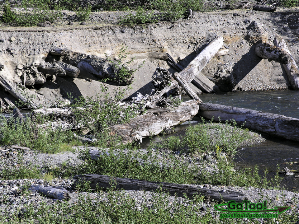
Damage and re-growth can be seen along this river bank in the blast zone. Remains of trees half buried in the ash and debris show how powerful the blast from the eruption was.
Close-up view of the mountain showing the large crater left behind when much of the northern face of the volcano blew off. Johnston Ridge Observatory offers excellent views of Mt. St. Helens, the crater and the destruction suffered in the area surrounding the mountain.
Boundary Trail at Mount St. Helens
The Boundary Trail is a National Recreation Trail. There are backpacking opportunities or shorter hikes from different access points along the pumice plains and ridges.
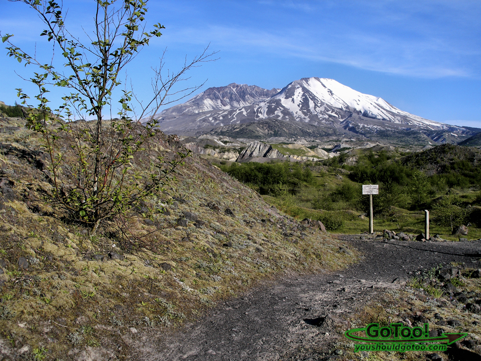
The area surrounding Mt. St. Helens was devasted by the volcano’s eruption in 1980. More than four decades later the landscape in the blast area is becoming renewed with a variety of plant and animal life. It was an amazing sight to see.
Mt. St. Helens Interesting Facts:
- March 20, 1980 – a magnitude 4.2 earthquake signaled the reawakening of Mt. St. Helens
- Spring 1980 – north face of the volcano pushed outward 5 ft per day by rising magma
- May 18, 1980 – a lateral blast, triggered by the largest terrestrial landslide in recorded history, reduced the summit by 1,300 ft
- Traveling at more than 300 miles per hour, the lateral blast blew down and destroyed 230 sq miles of forest within 3 minutes
- A vertical plume of ash from the volcano rose over 80,000 ft within a period of 15 minutes
- The volcanic mudflow damaged 27 bridges and homes and filled rivers with mud, sand and rocks
- The eruption of Mt. St. Helens in 1980 was the most economically destructive volcanic event in U.S. history
Viewing the destruction caused by the eruption and the re-growth of the natural habitat in various stages was something we will never forget. If you are in the Washington State area and have the opportunity I hope you will visit Mount St. Helens National Volcanic Monument. I think you will be amazed at what you see.
We would suggest the sites below for more information:
For more information on Exploring Mt St Helens – The USDA Forest Service
For more information on The Johnston Ridge Observatory – The USDA Forest Service
Have you visited Mt. St. Helens? What were your impressions of the area?
Tell us your thoughts in the comments below, we’d love to hear from you!





I was around when that happened. I still remember watching the cloud across the sky. Since then I’ve been up there multiple times. It’s awe-inspiring to go to what is left of Spirit Lake and see the thousands of dead trees just floating in the water down there.
The eruption of Mt. St. Helens was an incredible event in history, it must have been amazing to witness. I know what you mean about Spirit Lake, we were totally amazed to see the devastation and what is left of that area now.